We extensively covered the unusually strong El Niño, its weather impacts by region, and the risks this adverse weather poses to crop production and global food inflation.
Here's what this year's El Niño looks like next to the three strongest that came before it. What stands out to you? https://t.co/owJvWsOvZl
— Ben Noll (@BenNollWeather) October 3, 2026
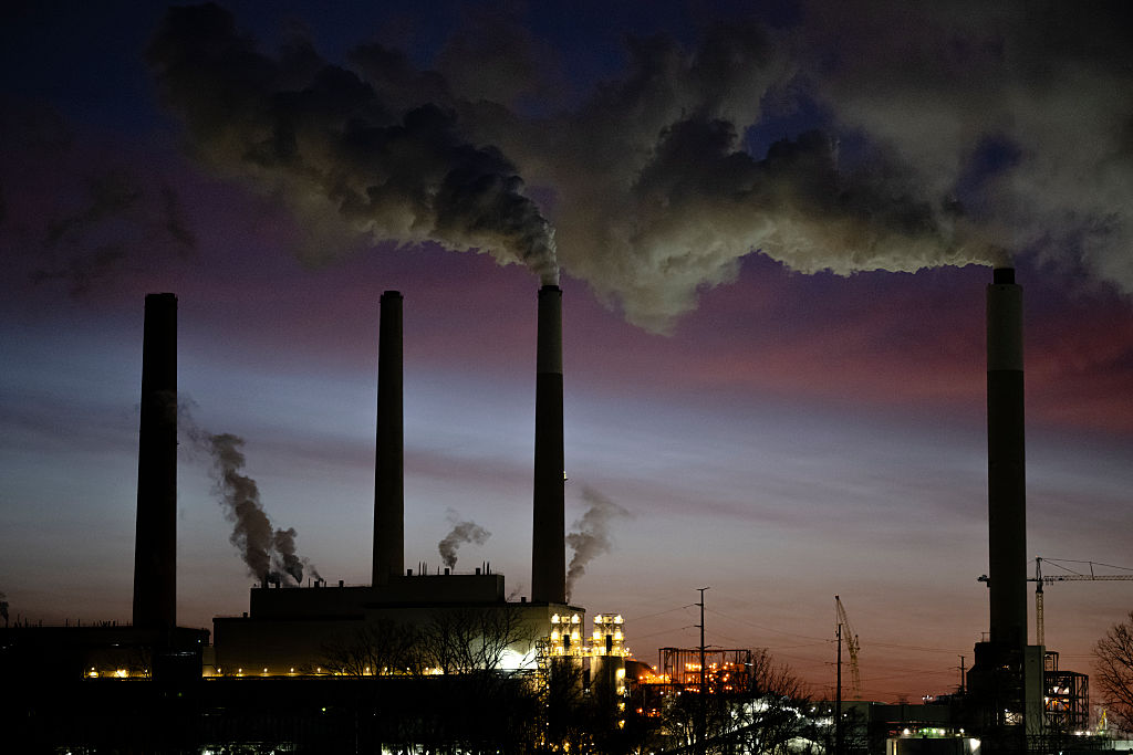
UBS's energy team hosted a call Tuesday with meteorologist James Block to assess El Niño impacts for weather markets. The discussion comes amid a global refining crisis and continued disruptions to Strait of Hormuz energy flows, with European natural gas futures approaching 90 euros per megawatt-hour this week.
Block offered some relief to energy consumers as the Northern Hemisphere approaches winter. He expressed high confidence that warmer-than-normal conditions will be present across several major energy-demand regions, including the northern US, Europe and parts of Asia. That could moderate heating demand as energy supplies, such as heating oil, remain tight.
Above-average temperatures, however, would not eliminate the risk of one or two cold blasts. Block warned of the potential for "black swan" events, including snowstorms and ice storms. In the Mid-Atlantic and Northeast, a powerful nor'easter coinciding with an Arctic cold outbreak could blanket major cities with heavy snow, even within a mild winter.
Here are the key takeaways from the discussion:
Strongest El Niño in more than 75 years
According to the expert, the current El Niño is unequivocally the strongest observed since modern sea surface temperature monitoring began in the 1950s. A "Super El Niño" is typically characterized by Pacific Ocean temperatures exceeding normal levels by more than 3°C, and the expert believes that anomalies could surpass 3.5°C this season. The event is expected to peak in January before gradually weakening, with conditions likely returning to normal by May 2027. While Super El Niño events generally result in milder winter weather, they can also generate so-called "black swan" weather events, including severe snowstorms and ice storms. Should such episodes occur, the expert believes they are most likely between late January and early February and would probably be short-lived, lasting between one and two weeks. Overall, however, the implication for energy markets is lower-than-average heating-related demand for this winter.
Regional outlooks
The impact from El Niño varies significantly by region. In the United States, the expert expects temperatures across the Northern Plains, Northeast and parts of Canada to average 1.5°C to 3°C above normal. In contrast, the Southern Tier is expected to experience cooler-than-average conditions. Texas, in particular, is likely to see colder and wetter weather than normal, although the probability of an extreme freeze event remains lower than in a typical winter. For Europe, the signal is less pronounced than in North America but still points towards a relatively mild season. The expert expects temperatures across Southern and Central Europe to average approximately 0.5°C to 1.5°C above normal. The impact is likely to be smaller in Northern Europe, although conditions are still expected to trend warmer than average overall. In Asia, confidence is highest for above-normal temperatures in India and Japan. Forecast signals for China are less robust, as weather patterns there are influenced more heavily by continental effects and local terrain. This is particularly relevant because energy demand is concentrated in northern China, where the warming signal appears weaker.
Beyond temperature: hurricanes, wind and precipitation
The discussion also covered the outlook for the remainder of the hurricane season, as well as expected wind and precipitation patterns. The expert does not anticipate any additional storms affecting the Gulf and highlighted the unusually quiet hurricane season to date, which has produced only one significant storm. Wind conditions in the United States are expected to benefit from a more southerly storm track, leading to stronger wind speeds, particularly in key wind-power generation regions. The outlook for Europe is less certain. On precipitation, the southern United States is expected to experience a wetter and stormier pattern, resulting in higher rainfall and improved water availability. Europe, by contrast, is expected to be both warmer and drier than average.
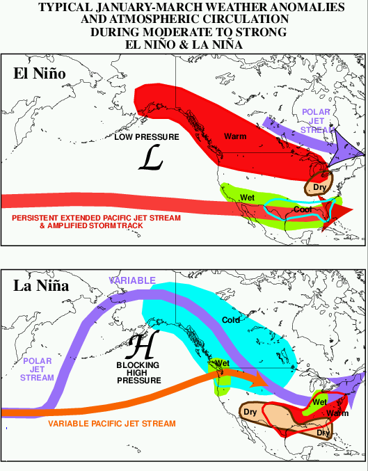
US Weather Pattern For El Niño & La Niña Winter
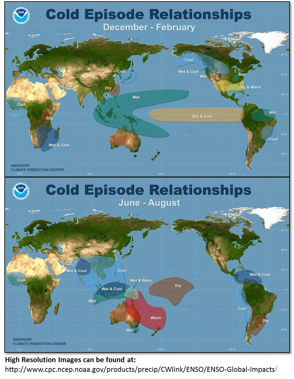
Global El Niño Weather Pattern
Related:
So far, El Niño-related increases in vertical wind shear have helped suppress Atlantic tropical cyclone development, with no tropical development or storms hitting the US East Coast.